

Transform your mapping and surveying endeavors with our state-of-the-art mapping drones. Experience the future of geospatial data collection as we effortlessly capture high-resolution aerial imagery and 3D terrain models. Our mapping drones deliver accurate and detailed results from construction site management to infrastructure development. Elevate your projects to a whole new level with our cutting-edge drone technology.
Orthomosaics
Dive into the world of crisp and accurate mapping with our ortho photos. From land development to environmental analysis, our orthoimagery solutions provide unparalleled visual clarity and detail. Experience the power of precision and elevate your projects with our advanced ortho photo technology.


Digital Surface Model
Discover a new dimension of mapping and surveying with our drone-generated elevation maps. From construction site planning to environmental assessments, our high-resolution drone data provides unparalleled insights. Unlock the power of precision and elevate your projects with our advanced elevation mapping solutions.


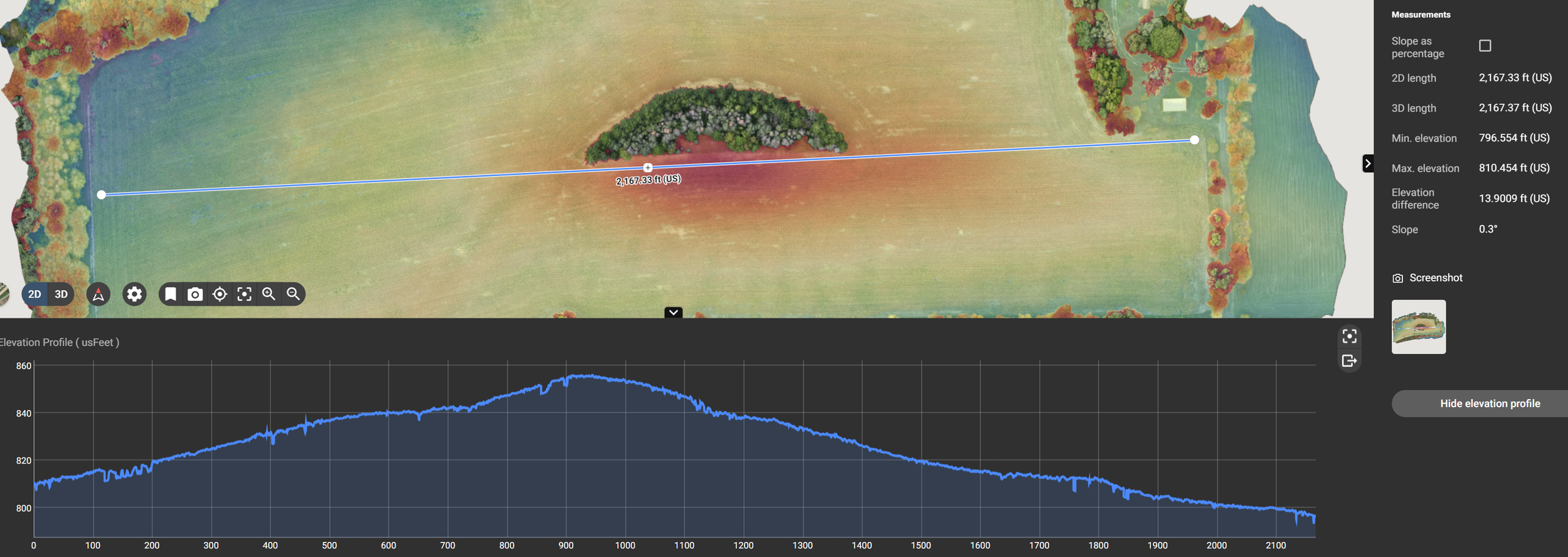


Precise Measurements
Unlock the potential of precise terrain details, including stockpile volumes and distance measurements, using our advanced technology. Whether you're managing construction sites or optimizing resource allocation, our tools provide unparalleled accuracy and efficiency. Elevate your project's performance with the power of exact measurements and comprehensive terrain insights.


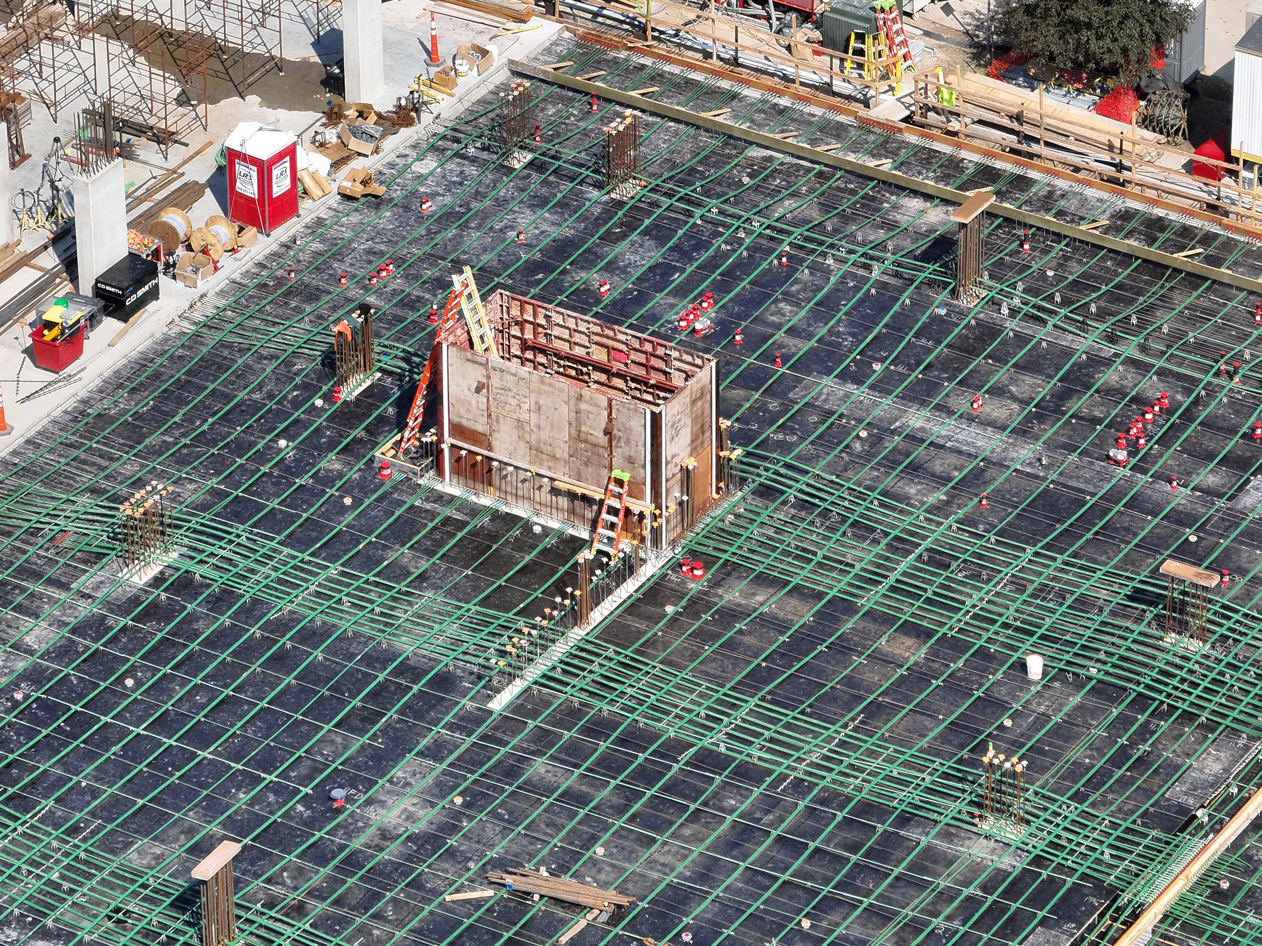
Job Sites/Project Progress and Planning
Gain the upper hand in project management with our advanced tools for tracking job sites and monitoring project progress. Whether you're overseeing construction or managing complex endeavors, our solutions empower you to identify issues early on, ensuring timely resolutions. Elevate your project management efficiency and stay in control with real-time insights that make a difference.


Photogrammetry
Discover the future of infrastructure and building modeling with our cutting-edge drone technology. Capture stunning aerial imagery and transform it into precise 3D models, enabling efficient planning, analysis, and maintenance. Explore how our drones revolutionize the way you view and manage your projects from every angle.


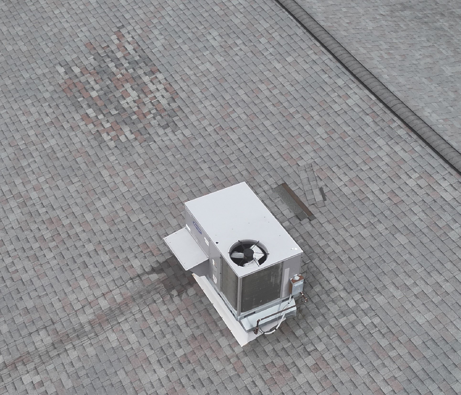
Infrastructure Monitoring
Using a drone to monitor infrastructure offers a cost-effective and efficient solution for inspecting hard-to-reach areas, such as wind turbines and cell towers. One of the key advantages of this technology is the integration of zoom cameras, allowing inspectors to obtain up-close, high-detail images of structural elements, facilitating early detection of defects or signs of wear. This enhanced visual capability not only ensures the safety of critical infrastructure but also minimizes the need for risky manual inspections.


Insurance
Experience a game-changing approach to insurance assessments. Our advanced drones provide fast, accurate, and comprehensive data for claims processing, risk assessment, and property evaluation. Discover the future of insurance inspections with precision and efficiency like never before.

Dident see an example matching your aerial mapping needs?
This is only a glimpse of what these incredible devices can achieve. If you don't see an exact example of what you need, drones offer limitless possibilities. Please reach out so we can work together to tailor a solution that perfectly aligns with your goals.